Photograph by John E. McDonald
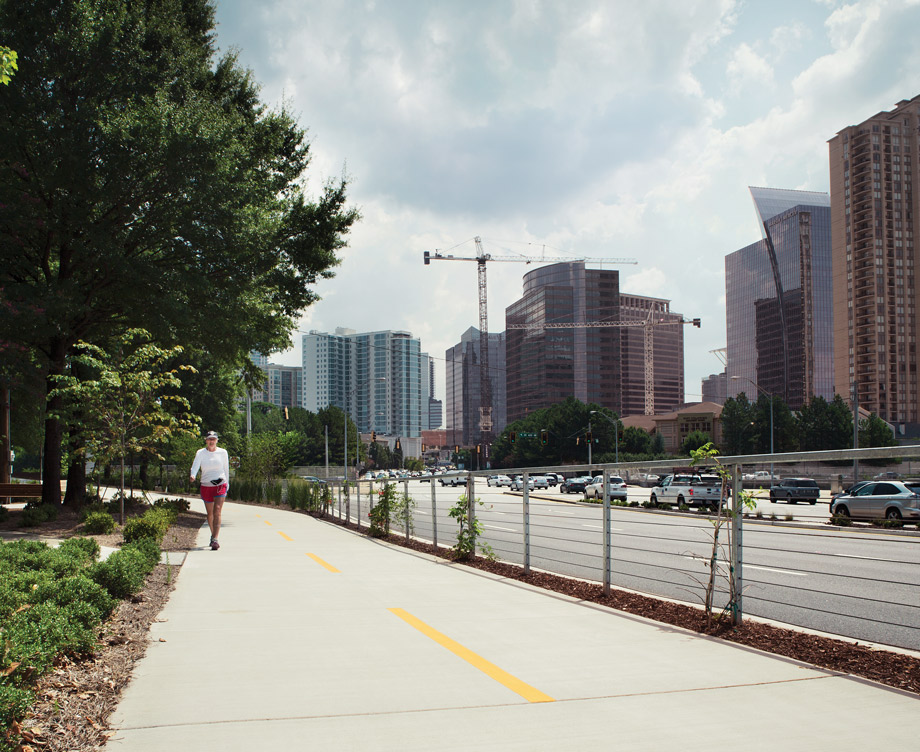
Like the Atlanta BeltLine, Buckhead’s PATH400 is converting otherwise unused stretches of land into publicly accessible greenspace—but that’s where the similarities end. While the 22-mile BeltLine traces old railroad beds, PATH400 takes advantage of undeveloped Georgia Department of Transportation rights-of-way that had come to feel like an extension of residents’ backyards.
So when Livable Buckhead, PATH400’s master developer, announced plans to covert the unused property into parkland, some residents felt like the trail was an intrusion into their space rather than a boon to a community without enough parks. (A 2009 study showed Buckhead has just 2.14 acres of park space per 1,000 residents, a fraction of the citywide average in Atlanta, which already is below its national peers.) Denise Starling, executive director of Livable Buckhead, made the project her baby. For it to thrive, she knew residents had to support the plan as enthusiastically as its other stakeholders (which include GDOT and the Buckhead Community Improvement District). She and project designer Carlos Perez headed into Neighborhood Planning Units as well as homeowners’ kitchens and backyards. The goal: find mutually beneficial design solutions—like planting trees on the trail to serve as a screen between people’s windows and the newly trafficked space.
PATH400’s use of rights-of-way has caught on. Sandy Springs and Dunwoody have similar developments in the works, and Brookhaven expects to draw from the model as it develops trails along the North Fork of Peachtree Creek.
Cast your vote for Groundbreaker of the Year
This article originally appeared in our September 2015 issue.