Photograph by Caroline C. Kilgore; courtesy of the Kenan Research Center at the Atlanta History Center
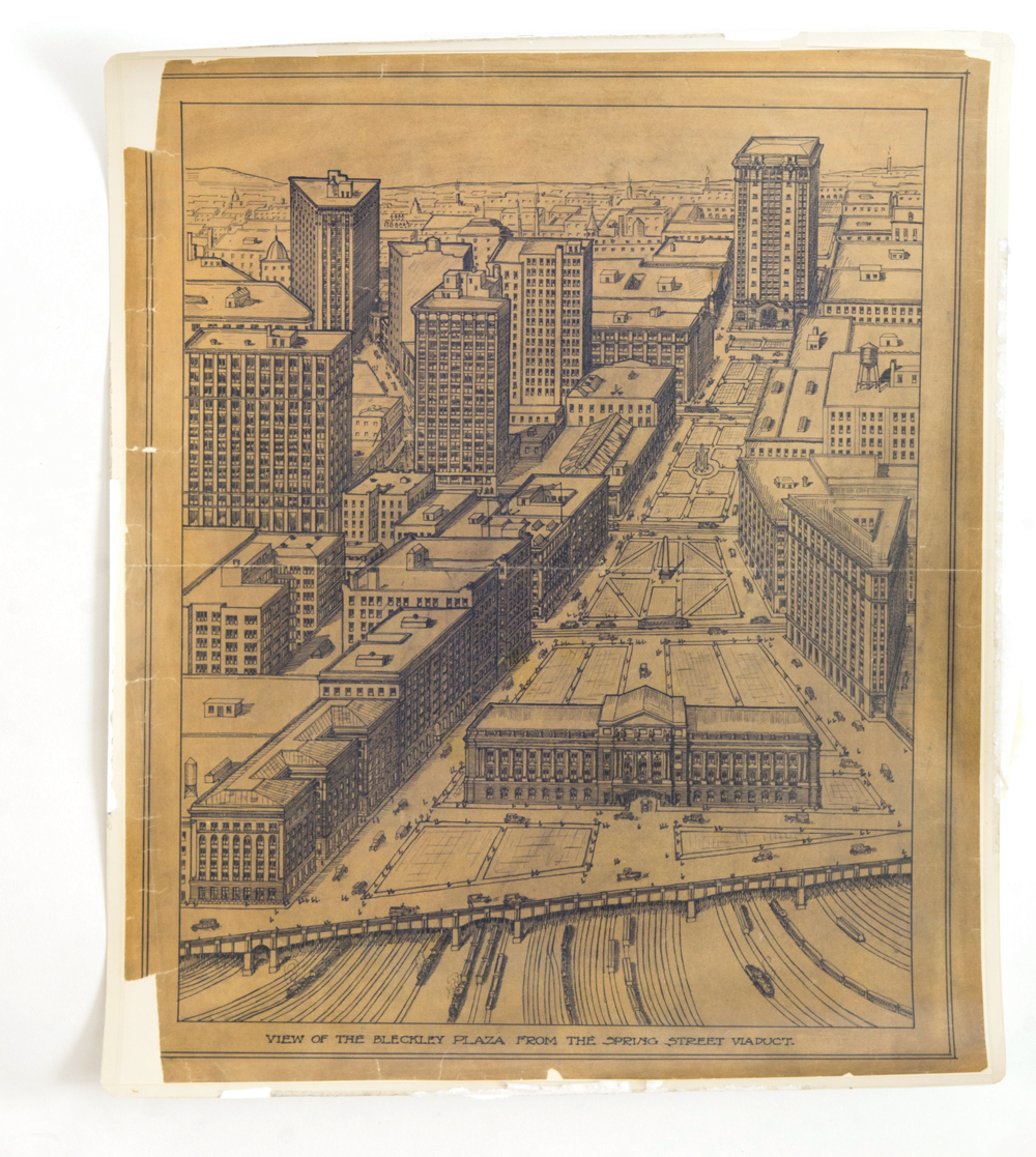
The OG Stitch
1909
The recent proposal to pave a “stitch” over the Connector isn’t a new concept. This European-style pedestrian plaza, developed by the Atlanta Aldermanic Board and the Chamber of Commerce, was similarly intended to close the gap over the dangerous railroad gulch downtown.

Photograph courtesy of the Kenan Research Center at the Atlanta History Center
Futuristic utopia
1910
Greater Atlanta Magazine (no relation to this one) ran this depiction of a 2010 Atlanta, where pedestrians hop on gondolas suspended by dirigibles and file in orderly lines from, gasp, self-powered streetcars.
Photograph copyright the Atlanta Regional Commission. Made available under a Creative Commons Attribution License (CC by 4.0)
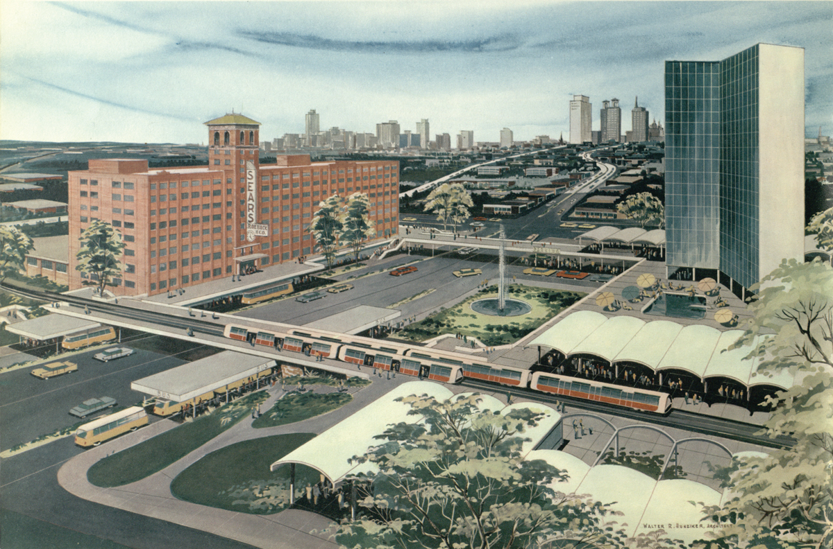
MARTA, MARTA everywhere
1961
The Atlanta Regional Commission’s original plan for MARTA extended northwest to Vinings, Smyrna, and Marietta, and east to Cheshire Bridge and Emory. North-south intown stops would have included Ansley Park and Ponce de Leon. “A person living in Decatur,” the plan reads, “can ride the ‘rapid’ to work at Lockheed or Marietta.”