Photograph by Gregory Miller
Atlantans is a first-person account of the familiar strangers who make the city tick. This month’s is Nicolaus Sherrill, a 25-year-old with an ambitious project, as told to Josh Green.
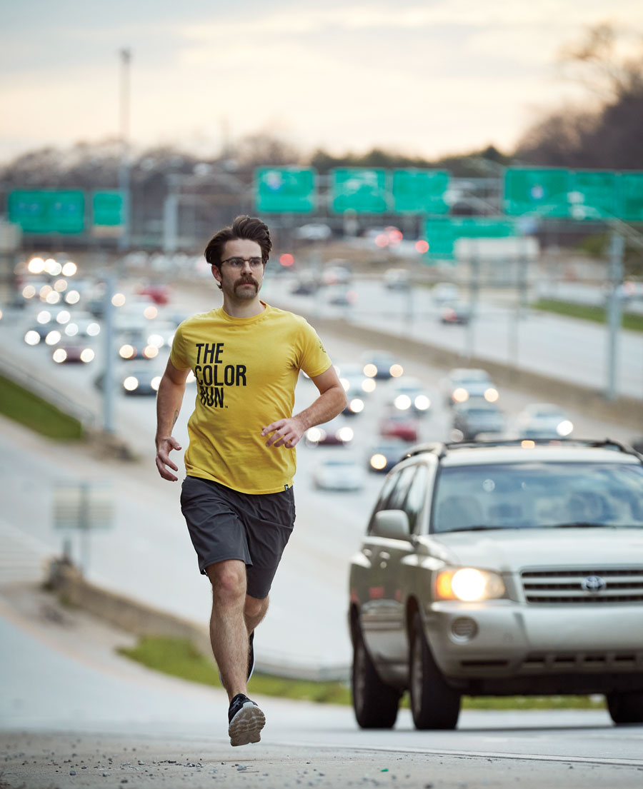
I have run on every single highway in this city. I’ve run every section of major railroad. I ran across a couple of lanes of the Connector in order to properly map Midtown. I did actually run into a pack of wild dogs once, when I was running in southwest Atlanta’s Pittsburgh neighborhood. A train had just come by on the Norfolk Southern line. I let it pass and then I saw a pack of wild dogs on the other side of the tracks. That was only neighborhood number two for me [of 242 officially defined by the city]. It was a very unsettling moment.
I grew up in Marietta. I hung out with the kids across the cul-de-sac every day. It was the typical suburb. Once I started driving, literally every weekend I was coming into the city. I can pinpoint spots on every highway where Atlanta slowly unveils itself from behind the trees. There’s a certain feeling you get, especially as a younger person not living in the city: Whoa, I’m here! I love cities, and I love this city, the melding of cultures. Now, I live here and work as a brand-identity designer.
On New Year’s Eve 2018, I thought it’d be fun to try to run every street in my neighborhood, Adair Park, and see how it looked on the Strava app, which I use to map my runs and bike rides. I finished the run and looked at the map and was like, This looks awesome. I decided I was going to do the whole city. I didn’t really have a name lined up, but it became “All the Neighborhoods ATL,” or “ATN ATL.”
There’s a wealth of maps on the city’s website and other places online. Once I figure out which neighborhood I am going to tackle, it is a lot of checking the streets on Google Maps. And I have to ask myself how far I’ll go. Am I going to have to cut through someone’s backyard? Am I gonna have to get on the train tracks? Climb a wall or a fence?
I had residents threaten to call the cops on me a couple times. I knocked on someone’s door, and they did not want me anywhere on their property, so I got out of there fast. On the flipside, I’ve been able to engage in amazing conversations with people when I knocked on their door to ask for permission to come on their property. One gentleman, in Laurens Valley, had lived there for 40 years. With all the new construction in his neighborhood, he was nervous about the potential for displacement of longtime residents but excited that investment would find its way into long-neglected communities.
Downtown was symbolic to run: It’s where the city started, and seeing it from the perspective of running its outline was immensely powerful. I’ve discovered nature trails and parks, especially on the southern end of the city. In Ormewood [Park], I found this amazing old pedestrian bridge that the trees had reclaimed, creating this natural archway. I’ve run more than 800 miles and 123 neighborhoods so far; my goal is to do all of them by the end of this year.
Ultimately, it’s a project to understand the city on an intimate level, both geographically and ethnographically. I see how all these neighborhoods come together and the purpose that they play. I hope it’ll inspire somebody else to get out there, maybe run a route that I ran. Everybody is so neighborhood- and community-driven in this city. Maybe this could help them become more familiar with where they live, their place in Atlanta, and the impact they could have, continuing the legacy of their land.
This article appears in our March 2020 issue.